Not a catchy title – sorry about that! I’m going to continue to update this post with the wild wind and waves we’re experiencing with this storm. I will continue to update this post with the newest information “on top” – under this intro.
Tides: 5.5 at 2:22 pm and 9.5 at 7:22 pm. High Wind Warning in effect until noon today.
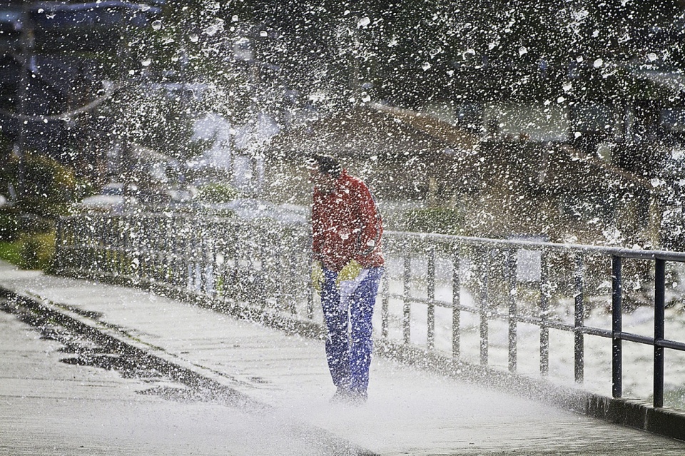
11:50 update: I’m guessing this video is from around 6:00 – 6:30 this morning.
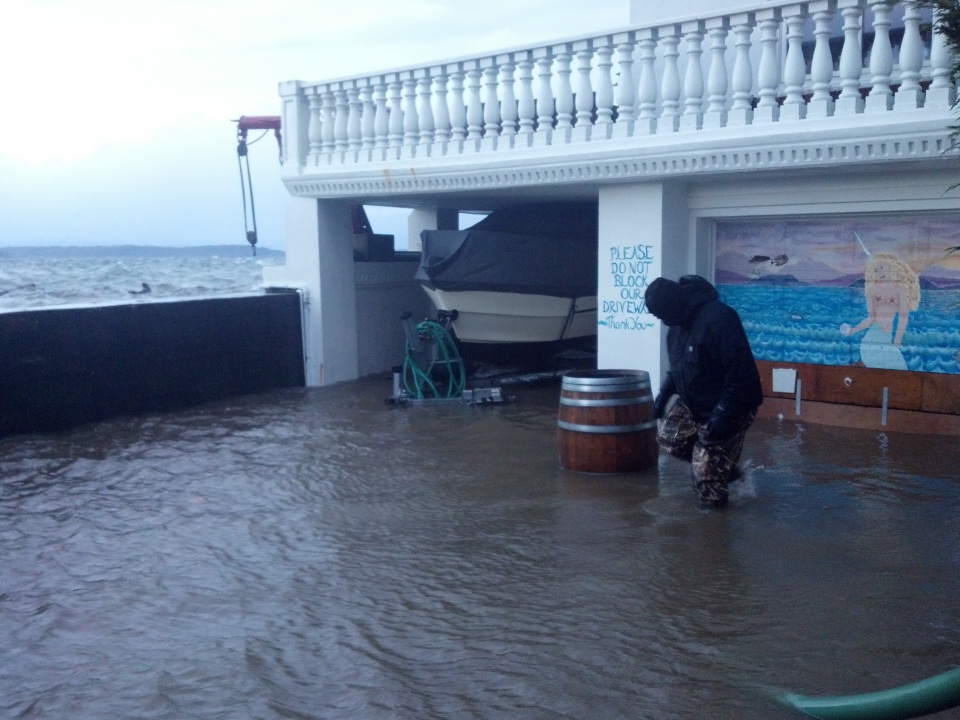
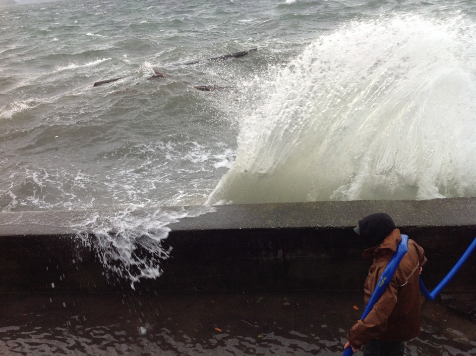
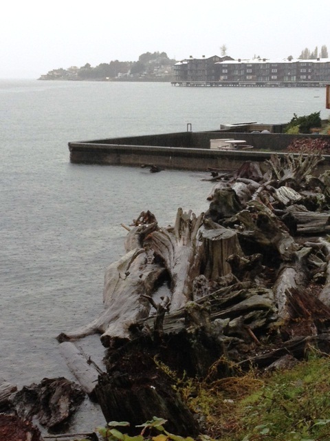
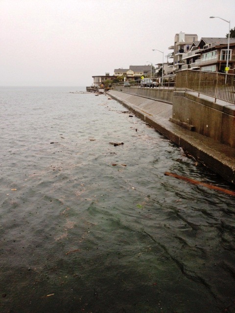
11:00 update: some of our photos
View from our deck looking down at our driveway
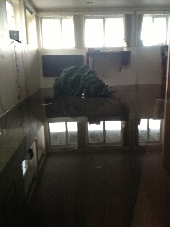
Our garage – this is actually looking good!
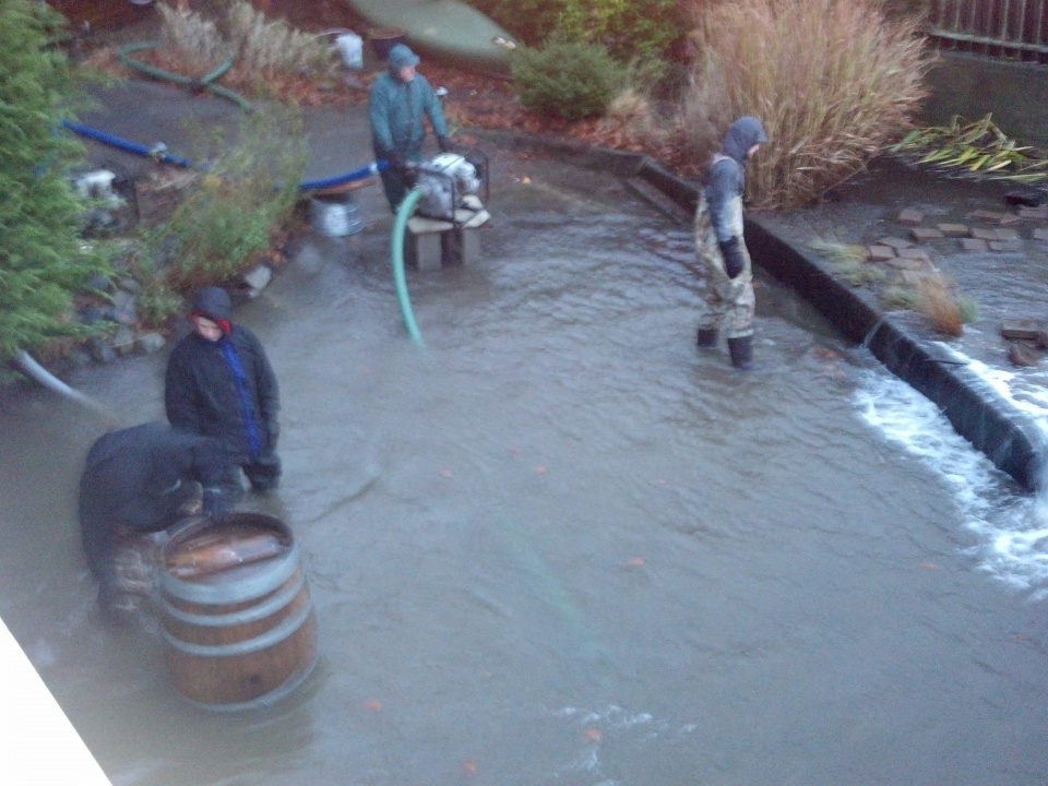
10:50 – photos of some neighbors who had their basement apartment flood despite having pumps.
tree
Update 10:37 am: Learning that many neighbors, even those who had pumps, have flooded. Updated puget Sound Marine forecast below
Puget Sound Marine Forecast:
…GALE WARNING IN EFFECT UNTIL 3 PM PST THIS AFTERNOON…
TODAY…SW WIND 25 TO 35 KT…EASING TO 20 TO 30 KT THIS AFTERNOON. WIND WAVES 5 TO 7 FT. SHOWERS IN THE MORNING…THEN SCATTERED SHOWERS.
TONIGHT…SW WIND 20 TO 30 KT…EASING TO 10 TO 20 KT. WIND WAVES 3 TO 5 FT SUBSIDING. A CHANCE OF SHOWERS.
TUE…S WIND 5 TO 15 KT…BECOMING SW 10 TO 20 KT. WIND WAVES 1 TO 3 FT. A CHANCE OF RAIN OR SNOW SHOWERS IN THE MORNING…THEN SLIGHT CHANCE OF SHOWERS.
TUE NIGHT…S WIND 10 TO 20 KT. WIND WAVES 2 TO 4 FT.
WED…S WIND 5 TO 15 KT…RISING TO 15 TO 25 KT. WIND WAVES 1 TO 2 FT…BUILDING TO 2 TO 4 FT.
WED NIGHT…S WIND 15 TO 25 KT. WIND WAVES 2 TO 4 FT.
THU…S WIND 5 TO 15 KT. WIND WAVES 2 FT OR LESS.
FRI…E WIND 10 KT. WIND WAVES 1 FT.
We are still 2 hours away from a high tide of 12.9 at 8:17 am (plus the “anomoly” of 1.5 feet from the coastal flooding).
Video from about 6:30 am
Update: 6:15 am: The Seattle forecast (via UW) was updated 10 minutes ago with gusts now up to 60 mph and National Weather Service has issued a Wind Warning a half hour ago.
SEATTLE/BREMERTON AREA-
INCLUDING THE CITIES OF…SEATTLE…BREMERTON…SILVERDALE…
FEDERAL WAY…KENT
550 AM PST MON DEC 17 2012
…HIGH WIND WARNING IN EFFECT UNTIL NOON PST TODAY…
…COASTAL FLOOD ADVISORY IN EFFECT UNTIL 11 AM PST THIS MORNING…
TODAY…VERY WINDY. SHOWERS BECOMING SCATTERED THIS AFTERNOON. SOUTHWEST WIND 20 TO 35 MPH WITH GUSTS TO 60 MPH…DECREASING AFTER NOON. HIGHS IN THE UPPER 30S TO MID 40S.
TONIGHT…MOSTLY CLOUDY. A CHANCE OF RAIN SHOWERS IN THE EVENING… THEN A CHANCE OF SNOW SHOWERS AFTER MIDNIGHT. LOWS IN THE UPPER 20S TO MID 30S. SOUTHWEST WIND 10 TO 20 MPH WITH GUSTS TO 30 MPH BECOMING SOUTH 10 TO 15 MPH AFTER MIDNIGHT.
TUESDAY…PARTLY SUNNY. A CHANCE OF SNOW SHOWERS IN THE MORNING… THEN A CHANCE OF RAIN SHOWERS IN THE AFTERNOON. SNOW LEVEL NEAR 200 FEET. HIGHS IN THE MID 30S TO LOWER 40S. SOUTHWEST WIND 10 TO 15 MPH. GUSTS TO 30 MPH IN THE MORNING.
National Weather Service has issued a “Wind Warning”
High Wind Warning
URGENT – WEATHER MESSAGE
NATIONAL WEATHER SERVICE SEATTLE WA
526 AM PST MON DEC 17 2012
WAZ505-508-172000-
/O.UPG.KSEW.WI.Y.0037.000000T0000Z-121218T0000Z/
/O.EXB.KSEW.HW.W.0011.000000T0000Z-121217T2000Z/
EAST PUGET SOUND LOWLANDS-SEATTLE/BREMERTON AREA-
526 AM PST MON DEC 17 2012
…HIGH WIND WARNING IN EFFECT FOR THE SEATTLE METRO AREA…KITSAP
PENINSULA…AND EAST PUGET SOUND LOWLANDS UNTIL NOON PST TODAY…
THE NATIONAL WEATHER SERVICE IN SEATTLE HAS ISSUED A HIGH WIND
WARNING…WHICH IS IN EFFECT UNTIL NOON PST TODAY. THIS REPLACES
THE WIND ADVISORY THAT WAS PREVIOUSLY IN IN EFFECT.
* SOME AFFECTED LOCATIONS…SEATTLE…BREMERTON…BELLEVUE…
RENTON…BLACK DIAMOND…AND GRAHAM.
* WIND…FROM THE SOUTHWEST AT 25 TO 35 MPH WITH GUSTS NEAR 60 MPH
THIS MORNING WILL DIMINISH TO 15 TO 30 MPH WITH GUSTS NEAR 40
MPH BY MIDDAY.
* IMPACTS…HIGH WINDS CAN TOPPLE TREES…DOWN POWER LINES…
DAMAGE PROPERTY…AND CAUSE POWER OUTAGES.
PRECAUTIONARY/PREPAREDNESS ACTIONS…
MOTORISTS…ESPECIALLY THOSE WITH HIGH PROFILE VEHICLES…SHOULD
BE ALERT FOR SUDDEN…STRONG CROSS WINDS.
A HIGH WIND WARNING MEANS DAMAGING WINDS ARE OCCURRING OR IMMINENT.


Recent Comments