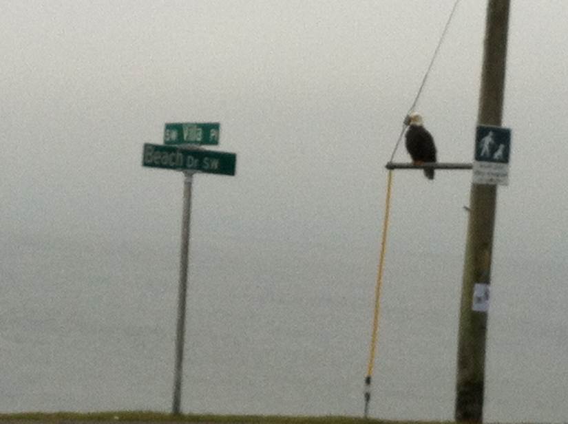
A couple more homes decked out for the holidays to share with you. If we’re missing your Beach Drive home, pet dressed up as on of Santa’s helpers or you have a favorite holiday recipe you’d like to share with your Beach Drive neighbors, please let us know!
NWS issues Coastal Flooding Watch for Monday morning and High Wind Watch with Gusts up to 60 mph
Coastal Flood Watch
COASTAL HAZARD MESSAGE
NATIONAL WEATHER SERVICE SEATTLE WA
202 PM PST SAT DEC 15 2012
…TIDAL OVERFLOW AND COASTAL FLOODING ARE POSSIBLE MONDAY…
.A STRONG LOW PRESSURE SYSTEM WILL MOVE THROUGH WESTERN WASHINGTON
MONDAY MORNING. HIGH TIDES AND BIG WAVES MAY PRODUCE TIDAL
OVERFLOW AND FLOODING NEAR THE BEACHES…
WAZ001-503-506>511-514-515-161230-
/O.NEW.KSEW.CF.A.0006.121217T1400Z-121217T1800Z/
SAN JUAN COUNTY-WESTERN WHATCOM COUNTY-WESTERN SKAGIT COUNTY-
EVERETT AND VICINITY-SEATTLE/BREMERTON AREA-TACOMA AREA-
ADMIRALTY INLET AREA-HOOD CANAL AREA-
EASTERN STRAIT OF JUAN DE FUCA-WESTERN STRAIT OF JUAN DE FUCA-
202 PM PST SAT DEC 15 2012
…COASTAL FLOOD WATCH IN EFFECT FOR MONDAY MORNING…
THE NATIONAL WEATHER SERVICE IN SEATTLE HAS ISSUED A COASTAL
FLOOD WATCH…WHICH IS IN EFFECT MONDAY MORNING.
* HAZARD…WAVES AND TIDAL ANOMALY AT HIGH TIDE.
* IMPACTS…TIDAL OVERFLOW AND FLOODING NEAR THE BEACHES.
* TIME OF HIGH TIDE…8 OR 9 AM.
* TIDE TABLE PREDICTION…12.9 FT SEATTLE…9.7 FT PORT
TOWNSEND…10.5 FT CHERRY POINT.
* EXPECTED TIDAL ANOMALY…1 TO 2 FEET.
PRECAUTIONARY/PREPAREDNESS ACTIONS…
A COASTAL FLOOD WATCH MEANS FLOODING OR BEACH EROSION WILL OCCUR
IF WEATHER CONDITIONS DEVELOP AS PREDICTED. RESIDENTS AND LOCAL
OFFICIALS SHOULD MONITOR THE SITUATION CLOSELY AND BE PREPARED TO
TAKE APPROPRIATE ACTION IF A WARNING IS ISSUED.
High Wind Watch
URGENT – WEATHER MESSAGE
NATIONAL WEATHER SERVICE SEATTLE WA
851 PM PST SAT DEC 15 2012
…A STRONG LOW PRESSURE SYSTEM WILL BRING A THREAT OF HIGH WINDS
TO WESTERN WASHINGTON FROM LATE SUNDAY AFTERNOON THROUGH MONDAY
MORNING…
.A 975 MB SURFACE LOW IS EXPECTED TO DEVELOP OFF THE COAST OF
WASHINGTON ON SUNDAY. LATEST COMPUTER MODELS INDICATE THE LOW
CENTER WILL MOVE ONTO THE WASHINGTON COAST EARLY MONDAY MORNING.
THE EXACT TRACK OF THE SURFACE LOW REMAINS SOMEWHAT UNCERTAIN AND
WILL HAVE A BIG IMPACT ON WHERE HIGH WINDS DEVELOP.
WAZ504-505-507>509-511-512-161400-
/O.CON.KSEW.HW.A.0009.121217T0800Z-121217T2000Z/
SOUTHWEST INTERIOR-EAST PUGET SOUND LOWLANDS-EVERETT AND VICINITY-
SEATTLE/BREMERTON AREA-TACOMA AREA-HOOD CANAL AREA-
LOWER CHEHALIS VALLEY AREA-
851 PM PST SAT DEC 15 2012
…HIGH WIND WATCH REMAINS IN EFFECT FROM LATE SUNDAY NIGHT
THROUGH MONDAY MORNING…
* SOME AFFECTED LOCATIONS…SEATTLE…EVERETT…BELLEVUE…
TACOMA…OLYMPIA…SHELTON…AND CHEHALIS.
* TIMING…SOUTHWEST WINDS WILL RISE BEHIND A STRONG LOW
PRESSURE SYSTEM LATE SUNDAY NIGHT AND MONDAY MORNING.
* WIND…SOUTHWEST WINDS RISING TO 25 TO 35 WITH GUSTS TO 60 MPH.
* IMPACTS…WINDS THIS STRONG CAN TOPPLE TREES…DOWN POWER
LINES…AND DAMAGE SOME STRUCTURES.
PRECAUTIONARY/PREPAREDNESS ACTIONS…
A HIGH WIND WATCH MEANS THERE IS THE POTENTIAL FOR A DAMAGING
WIND EVENT.
Why was the dog barking this morning?
You may have heard the dog barking around 3:00 this morning and wondered if it was locked out or alone in it’s home. We had a couple emails asking if we knew what was going on with the barking dog so we posted it on our Facebook page.
As it turns out, a dog was actually trapped in the bulk head boulders off of Emma Schmitz View Point this morning. Lucky for this dog, a couple of bicyclist were passing by around 5:00 am this morning when they heard the dogs constant barks.
From our Facebook page:
“We were out on our morning bike ride, heard barking coming from down by the water, took off our bike lights, and investigated along with another “early morning-er”. We called for Police/Fire help because we could get him out of the rocks. He was trapped *inside* the rock bulkhead”
The pup was taken to Lien Animal Clinic where they were able to find his microchip and reunite him with his owners.
We are so thankful for Dawnie and her fellow “early morning-er” as well as the SPD and Fire Department for rescuing this pup. In my opinion, they’re all heroes!
More Ho Ho Homes dressed up for the Holidays
Seattle Police Department Community Safety Newsletter
This issue addresses recent burglary attempts and includes many good tips. Click here to read it.
Beach Drive Holiday Homes
We thought we’d share some photos of neighborhood homes that are decked out for the holidays along Beach Drive.

You could say this home by Lowman Beach is being “ducked” out for the holidays.

We like Santa’s four legged friends on the deck of this home.

Perched above Beach Drive

Joy to all!
Would you like to have your festive Beach Drive home or decorated pet featured on Beach Drive Blog? Please send us a photo!
Don’t Miss “Santa’s First Magical Ride: The Musical”
We received this press release from Libby Carr and had to share it with you!
“SANTA’S FIRST MAGICAL RIDE: THE MUSICAL”
PREMIERES IN SEATTLE Dec 7 – 23, 2012
Local Author & Playwright team up to create new Christmas musical
Seattle, WA, November 24, 2012: “Santa’s First Magical Ride: The Musical” is a new tale about why Santa took that first magical ride and his life with the North Pole Elves. It features original music, songs and lively dance numbers, and was written by Ricky Gene Powell and Paul S. Carr III. The new musical is being performed at the Youngstown Cultural Arts Center in Seattle the three weekends just before Christmas. All tickets are $15, and can be obtained through Brown Paper Tickets (www.brownpapertickets.com).The musical is based on the book, “Santa’s First Magical Ride,” written by Paul S. Carr III and first published in December 2011. The book, written entirely in rhyme, tells the story of Santa’s birth and adoption by the North Pole Elves, his magical upbringing, and the story of his first magical sleigh ride. Ricky Gene Powell and Paul S. Carr III are both professional singers and musicians who combined Paul’s story with Ricky’s expertise as a playwright and director to create a charming new musical story with original bluegrass, celtic, and folk music that will make you want to dance along with the Elves. Bring cameras since children can visit with Santa afterwards and parents can take a free picture.
Tickets are available through Brown Paper Tickets by calling 1-800-838-3006 or at www.brownpapertickets.com. Interview arrangements and other information is available at www.yulestory.com, or by contacting Libby Carr, Executive Producer, at libby@yulestory.com; 206-938-8721. We also welcome groups and organizations who want to enjoy this experience together and we will promote their attendance on Brown Paper Tickets. Call Libby Carr (206-938-8721) for more info on how your group can celebrate by attending this event together.
# # #
What: The premiere of “Santa’s First Magical Ride: The Musical”
When: Twelve performances on Dec 7-9; Dec 14-16; Dec 21-23
(2:00 PM Matinees on Sat & Sun & 7:00 PM Fri & Sat nights)
Where: Youngstown Cultural Arts Center Theatre (West Seattle)
4408 Delridge Way SW, Seattle, WA 98106
Who: Written by Paul Carr & Ricky Gene Powell, Director: Ricky Gene Powell; Executive Producer: Libby Carr
Why: To present a fresh new Christmas musical that tells the story of where Santa came from as a young child and how he was raised by the North Pole Elves. Important questions like “How DO the reindeer fly?” (and much more), are finally answered. A portion of the proceeds will go to benefit Ignite, a local organization encouraging young girls to go into the sciences, technology and engineering.
Photo of High Tide compliments of West Seattle Herald and David Rosen
This photo was taken by David Rosen at Charles Richey Sr Viewpoint off of Beach Drive
Check out more photos of our weather via West Seattle Herald.
NWS issues Coastal Flood Advisory and Special Weather Statement on Landslides
Tis the Season! The National Weather Service has issued a Coastal Flood Advisory and Special Weather Statement warning of Landslides.
…MINOR TIDAL OVERFLOW IS POSSIBLE THIS MORNING FOR PUGET SOUND.
HIGH ASTRONOMICAL TIDES AND LOW PRESSURES FROM A FRONT MOVING ONSHORE WILL PRODUCE MINOR TIDAL OVERFLOW FOR PARTS OF PUGET SOUND AND THE NORTH INTERIOR THIS MORNING….
THE NATIONAL WEATHER SERVICE IN SEATTLE HAS ISSUED A COASTAL FLOOD ADVISORY…WHICH IS IN EFFECT FROM 4 AM EARLY THIS MORNING TO NOON PST TODAY.
* HAZARD…MINOR TIDAL OVERFLOW NEAR THE BEACHES.
* IMPACTS…MINOR FLOODING IS POSSIBLE NEAR THE WATER AROUND THE
TIME OF HIGH TIDE.
* TIME OF HIGH TIDE…AROUND 9 AM AT SEATTLE.
* PREDICTED TIDE…11.93 FEET AT SEATTLE.
* EXPECTED TIDAL ANOMALY…1 TO 1.5 FEET.
PRECAUTIONARY/PREPAREDNESS ACTIONS…
A COASTAL FLOOD ADVISORY INDICATES THAT ONSHORE WINDS AND TIDES WILL COMBINE TO GENERATE FLOODING OF LOW AREAS ALONG THE SHORE.
… WITH AN ELEVATED LANDSLIDE RISK…RAINFALL INDUCED LANDSLIDES ARE POSSIBLE DURING BURSTS OF INTENSE RAINFALL OR WHEN THERE IS HEAVY RAINFALL OVER A PERIOD OF A DAY OR TWO AS NOTED IN THE FORECAST ELEVATED RISK LEVEL. A GRADUALLY DIMINISHING RISK OF LANDSLIDES WILL CONTINUE FOR SEVERAL DAYS AFTER THE RAIN ENDS. AREAS MOST SUSCEPTIBLE TO LANDSLIDES UNDER THESE CONDITIONS ARE STEEP COASTAL BLUFFS AND OTHER STEEP HILLSIDES.
FOR MORE INFORMATION ABOUT CURRENT CONDITIONS…VISIT WWW.WEATHER.GOV/SEATTLE…SELECT HYDROLOGY…AND THEN SCROLL DOWN FOR THE LINKS TO THE LANDSLIDE INFORMATION PAGES.
TO REPORT LANDSLIDES TO THE STATE FOR TABULATION…GO TO THE WASHINGTON STATE LANDSLIDE RISK WEB PAGE AND THE LINK FOR REPORTING.
…SMALL CRAFT ADVISORY IN EFFECT THROUGH WEDNESDAY MORNING…
TODAY…S WIND 15 TO 25 KT. WIND WAVES 2 TO 4 FT. RAIN IN THE MORNING…THEN SHOWERS.
TONIGHT…S WIND 15 TO 25 KT. WIND WAVES 2 TO 4 FT. SHOWERS IN THE EVENING…THEN SHOWERS LIKELY.
WED…SW WIND 15 TO 25 KT…EASING TO 5 TO 15 KT. WIND WAVES 2 TO 4 FT…SUBSIDING TO 2 FT OR LESS. SHOWERS LIKELY IN THE MORNING… THEN A CHANCE OF SHOWERS.
WED NIGHT…SW WIND TO 10 KT…BECOMING S 5 TO 15 KT. WIND WAVES 2 FT OR LESS
…COASTAL FLOOD ADVISORY IN EFFECT UNTIL NOON PST TODAY…
TODAY…BREEZY. RAIN TURNING TO SHOWERS BEFORE NOON. HIGHS IN THE UPPER 40S TO MID 50S. SOUTH WIND 15 TO 25 MPH. GUSTS TO 35 MPH THIS MORNING.
TONIGHT…BREEZY. SHOWERS. LOWS IN THE UPPER 30S TO MID 40S. SOUTH WIND 15 TO 25 MPH BECOMING SOUTHWEST AFTER MIDNIGHT. GUSTS TO 35 MPH.
WEDNESDAY…BREEZY. SHOWERS LIKELY…THEN CLOUDY WITH A CHANCE OF SHOWERS IN THE AFTERNOON. HIGHS IN THE 40S. SOUTHWEST WIND 15 TO 25 MPH WITH GUSTS TO 35 MPH EASING TO 10 TO 15 MPH IN THE AFTERNOON.
Recent Comments