West Seattle Blog reports there’s a mudslide around the 6000 block of Beach Drive. I’m on my way out now to check it out. Photos to follow soon.
Update: Here are some photos of the mudslide…not too far from where we mentioned earlier.


All about the West Seattle neighborhood around Beach Drive
West Seattle Blog reports there’s a mudslide around the 6000 block of Beach Drive. I’m on my way out now to check it out. Photos to follow soon.
Update: Here are some photos of the mudslide…not too far from where we mentioned earlier.
 West Seattle Blog just published a wind advisory from the National Weather Service from 10 pm tonight until 4 pm Monday.
The Barking Dog is published (since that’s what my husband affectionately calls me) when I’m concerned about the weather, waves…etc.
Here are the current reports that I’m reviewing causing me to howl:
Marine Forecast for Puget Sound:
…GALE WARNING NOW IN EFFECT THROUGH MONDAY AFTERNOON…
TONIGHT…S WIND 25 TO 35 KT…RISING TO 35 TO 45 KT LATE THIS EVENING. WIND WAVES 4 TO 6 FT…BUILDING TO 6 TO 8 FT. RAIN.
MON…SW WIND 35 TO 45 KT…EASING TO 30 TO 40 KT IN THE AFTERNOON. WIND WAVES 6 TO 8 FT. RAIN.
MON NIGHT…SW WIND 20 TO 30 KT. WIND WAVES 3 TO 5 FT. SHOWERS LIKELY.
…WIND ADVISORY IN EFFECT FROM 10 PM THIS EVENING TO 4 PM PST MONDAY…
…FLOOD WATCH IN EFFECT FROM LATE TONIGHT THROUGH WEDNESDAY AFTERNOON…
TONIGHT…RAIN…WINDY. LOWS IN THE UPPER 30S TO MID 40S. SOUTH WIND 15 TO 25 MPH BECOMING SOUTHWEST AND INCREASING TO 25 TO 35 MPH AFTER MIDNIGHT.
MONDAY…RAIN…WINDY. HIGHS IN THE 50S. SOUTH WIND 25 TO 35 MPH.
MONDAY NIGHT…SHOWERS LIKELY. WINDY. LOWS IN THE 40S. SOUTHWEST WIND 25 TO 35 MPH DECREASING TO 15 TO 25 MPH AFTER MIDNIGHT.
Factor in a high tide of 11.4 at 12:15 tomorrow afternoon (we’re past high tide today) and you’ll see why I’m yippy.

This practically in the same location where trees came crashing down in the big wind storm last year on Beach Drive.
Video to follow soon…if I can figure this flippin’ thing out!
It could be nothing at all…but better to be safe than sorry. Here is the latest marine  forecast:
PUGET SOUND AND HOOD CANAL-
236 PM PST SUN NOV 11 2007
…SMALL CRAFT ADVISORY NOW IN EFFECT THROUGH MONDAY MORNING…
…GALE WARNING IN EFFECT FROM MONDAY MORNING THROUGH MONDAY AFTERNOON…
TONIGHT…S WIND 20 TO 30 KT. WIND WAVES 3 TO 5 FT. CHANCE OF SHOWERS EARLY…THEN CHANCE OF RAIN IN THE EVENING. RAIN AFTER MIDNIGHT.
MON…S WIND 20 TO 30 KT RISING TO 30 TO 40 KT IN THE LATE MORNING AND EARLY AFTERNOON…THEN BECOMING SW LATE. WIND WAVES 3 TO 5 FT BUILDING TO 5 TO 7 FT. RAIN IN THE MORNING…THEN SHOWERS IN THE AFTERNOON.
MON NIGHT…W WIND 15 TO 25 KT…BECOMING SW 10 TO 15 KT AFTER MIDNIGHT. WIND WAVES 1 TO 4 FT. SHOWERS IN THE EVENING…THEN SHOWERS LIKELY AFTER MIDNIGHT.
We have an 11.6 high tide at 7:06 a.m. for tomorrow morning (Monday) and a 9.7 at 4:47 p.m.
The Seattle forecast for Monday is (hang on to your hats):
MONDAY…SOUTH WIND 15 TO 25 MPH RISING TO 30 TO 40 MPH WITH POSSIBLE GUSTS TO 60 MPH LATE MORNING. WINDS EASING TO 15 TO 25 MPH MID AFTERNOON. RAIN. HIGHS NEAR 50.
MONDAY NIGHT…SHOWERS LIKELY. LOWS NEAR 40. SOUTHWEST WIND 15 TO 20 MPH DECREASING TO AROUND 10 MPH AFTER MIDNIGHT.
A veteran of 24 years of windsurfing and years on the Gorge, Jeff Beck, Seattle professional photographer, windsurfs in the storm of October 18, 2007, off of Lowman Beach Park. The wind was powerful, and Jeff snapped a boom while sailing. 
Photograph by neighborhood windsurfer, Ron Sterling, who lives on the south border of Lowman Beach Park. Ron says "I’m not up the level of windsurfing that 40 mph winds require, but you will see me off Lowman Beach Park just about any day the winds are above 12 mph and below 30. I’ve been at it for two and one-half years."
See picture below of Ron Sterling on a recent 18 mph day off Lowman Beach Park.

Editors note: Thanks to Ron Sterling for sharing his photos and stories with Beach Drive Blog readers. I look forward to his future contributions.
If you would like to contribute in your neighborhood blog, please contact me.
Around 1:30, the wind arrived, as if Mother Nature flipped a switch from calm to crazy. Hopefully we keep power or I’ll be blogging (when I can) from my cell phone!
Tides are around 10 feet currently.
According to our local weather station, compliments of the Lipskys, the wind is 27 mph with gusts of 43.
At least it’s sunny out (right now).
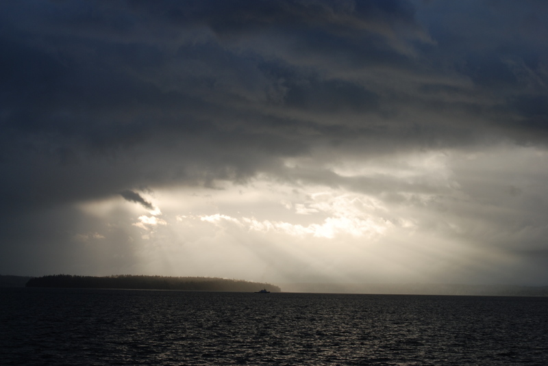
This photo is from last night.
The gale warning begins at noon today through this evening. From watching the news and reading the WS Blog, it looks like the wind and rain is going to hit around 2pm today.
The Seattle PI has great tips on what to do to prepare for a big storm.
Updated marine forecast:
PZZ135-181700-
/O.EXT.KSEW.GL.W.0048.071018T1900Z-071019T0200Z/
PUGET SOUND AND HOOD CANAL-
300 AM PDT THU OCT 18 2007
…GALE WARNING NOW IN EFFECT FROM NOON PDT TODAY THROUGH THIS EVENING…
TODAY…S WIND RISING TO 20 TO 30 KT IN THE MORNING…THEN RISING TO 30 TO 40 KT IN THE AFTERNOON. WIND WAVES 3 TO 5 FT BUILDING TO 6 TO 8 FT IN THE AFTERNOON. RAIN IN THE MORNING…THEN SHOWERS IN THE AFTERNOON.
TONIGHT…S WIND 30 TO 40 KT…BECOMING SW 20 TO 30 KT LATE IN THE EVENING…THEN BECOMING S 10 TO 20 KT AFTER MIDNIGHT. WIND WAVES 6 TO 8 FT…SUBSIDING TO 1 TO 3 FT AFTER MIDNIGHT. SHOWERS LIKELY.


Recent Comments