
A group of people where out with flashlights during the low tide (photo above).


All about the West Seattle neighborhood around Beach Drive
A group of people where out with flashlights during the low tide (photo above).
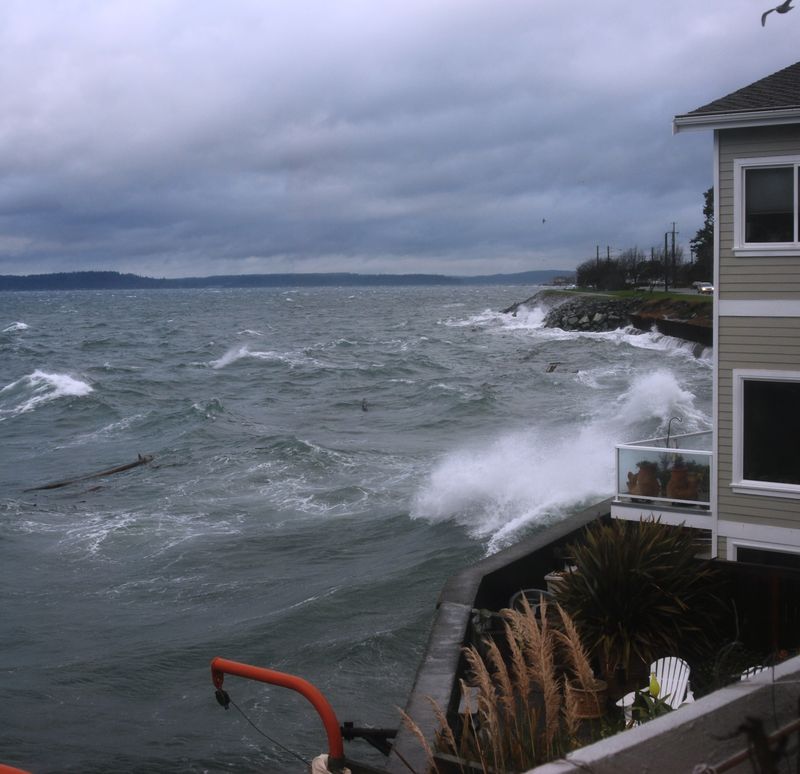
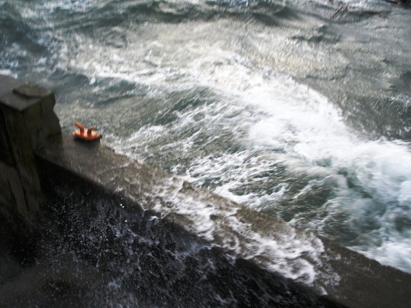
Our home prepared for the storm yesterday and I'm thankful that it was just a  practice run with just a few sloshes of water over the bulkhead and our bow was blown off our Christmas wreath.
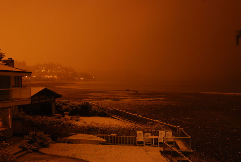
Now we're in for some record cold temperatures including possible snow!
Bundle up, stay warm and send us your winter or holiday photos to share at Beach Drive Blog.
For new readers of Beach Drive Blog, a "Barking Dog Report" is when our home is  preparing for a nasty storm. My husband (fondly) refers to me as a "barking dog" when I think trouble may be near as Inervously pace around the house. Based current forecasts on Friday, I think we could be in for a doozie.
Current Puget Sound Marine Forecast:
…GALE WARNING IN EFFECT FROM FRIDAY MORNING THROUGH FRIDAY EVENING…
FRI…S WIND 15 TO 25 KT…BECOMING SW 25 TO 35 KT MIDDAY. WIND WAVES BUILDING TO 4 TO 6 FT. RAIN.
FRI NIGHT…SW WIND 25 TO 35 KT…EASING TO 20 TO 30 KT LATE. WIND WAVES 4 TO 6 FT…SUBSIDING TO 3 TO 5 FT LATE.
Current City of Seattle Forecast:
FRIDAY…WINDY…RAIN DEVELOPING. HIGHS IN THE 40S. SOUTH WIND 10 TO 15 MPH INCREASING TO 20 TO 30 MPH IN THE AFTERNOON.
FRIDAY NIGHT…WINDY…RAIN CHANGING TO SHOWERS. SNOW SHOWERS POSSIBLE. LOWS IN THE 30S. SOUTHWEST WIND 20 TO 30 MPH.
Tides for tomorrow (Friday) are a 12.4 at 5:20 am; going down to 8.4 at 10:18 am and swooping up to a 12.1 at 3:01 pm. We have a low of -4.0 at 10:23 pm.
Like all neighborhood barking dogs, I hope I'm wrong for howling about the weather…it's always best to prepare. You can click on the links to receive updated forecasts. Hat tip to "Cat Woman" for bringing the weather to my attention.
The City of Seattle weather forecast has the "s-word" (snow) beginning Friday night: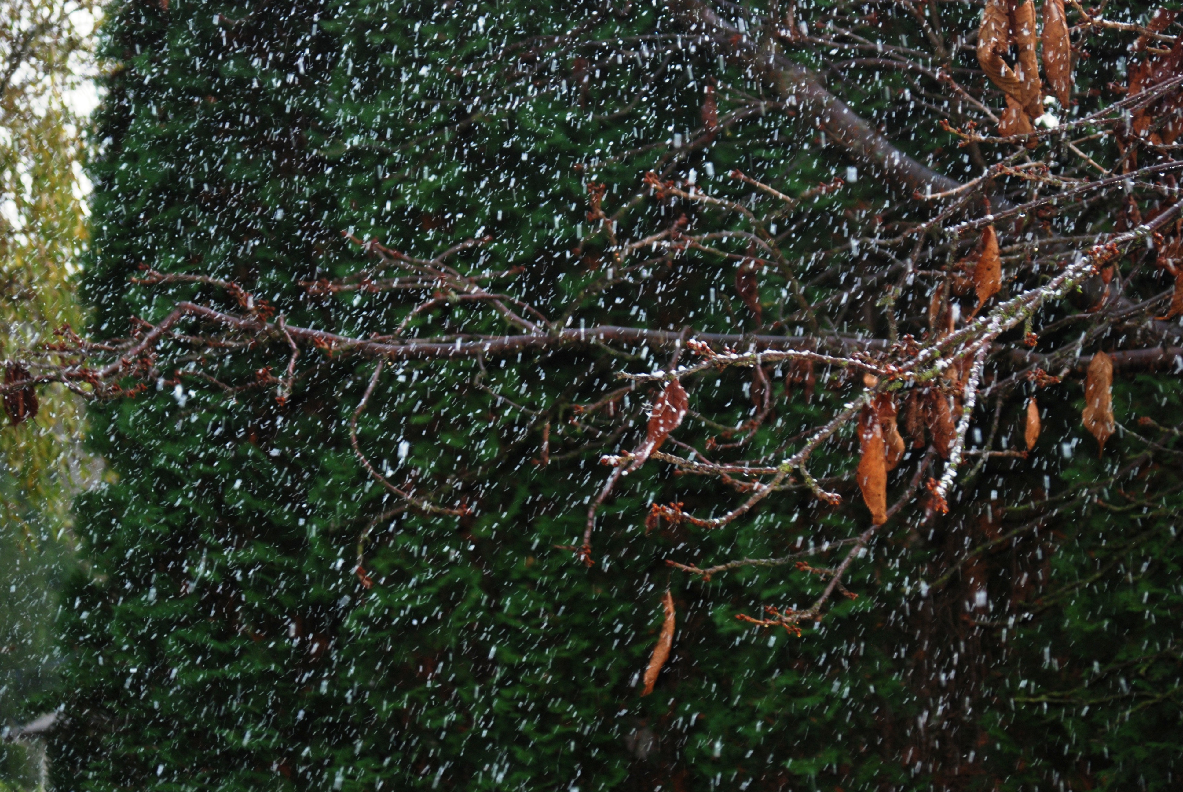
FRIDAY NIGHT…RAIN AND SNOW LIKELY. LOWS IN THE LOWER 30S.
and again on Saturday night:
SATURDAY NIGHT…MOSTLY CLOUDY WITH A CHANCE OF SNOW SHOWERS. LOWS IN THE UPPER 20S.
Which will make for a chilly, yet pretty viewing of the Argosy Christmas Ships as they cruise by this Saturday.
Today, the Puget Sound marine forecast has a small craft advisory in effect through this evening with winds from the east up to 30 kt this afternoon and 3 to 5 foot waves. High tide is a 11.8 at 11:28 am. With winds from the east, it should be pretty interesting to watch–especially if you're by Vashon or the other islands. The City of Seattle forecast confirms winds up to 20 mph from the east changing to the southwest later this afternoon.
Friday also promises to be windy and cold with lows in the mid 30s to lower 40s and south winds up to 25 mph…watch out Jeff Renner! LOL
You can always check updates by clicking under "Swell Links" on the left on this site.
With the forecast worsening, I thought we should provide an update (as of 9:20pm tonight) from today’s Barking Dog Report:
…WIND ADVISORY IN EFFECT FROM 10 PM THIS EVENING TO 10 AM PST WEDNESDAY…
TONIGHT…RAIN. BECOMING WINDY LATE. LOWS NEAR 50. SOUTH WIND 10 TO 15 MPH INCREASING TO 20 TO 30 MPH WITH GUSTS TO AROUND 45 MPH AFTER MIDNIGHT.
WEDNESDAY…WINDY…RAIN. HIGHS IN THE MID 50S TO LOWER 60S. WEST WIND 20 TO 30 MPH WITH GUSTS TO AROUND 45 MPH DECREASING TO 10 TO 20 MPH IN THE AFTERNOON.
…GALE WARNING IN EFFECT THROUGH WEDNESDAY MORNING…
TONIGHT…S WIND 15 TO 25 KT…RISING TO SW 25 TO 35 KT LATE. WIND WAVES 2 TO 4 FT BUILDING TO 4 TO 6 FT LATE. RAIN.
WED…SW WIND 25 TO 35 KT…EASING TO 15 TO 25 KT EARLY IN THE AFTERNOON. WINDS EASING TO SW 10 TO 20 KT LATE. STRONGEST WINDS SOUTH SOUND. WIND WAVES 3 TO 6 FT…SUBSIDING TO 1 TO 3 FT LATE. RAIN.
Our next high tide is 11.2 feet at 4:22 am and then an 11.9 at 2:54pm. Hopefully this report is just your like your neighborhood barking dog and nothing more…but since we try to keep up with this stuff, just thought we’d share it with you.
With the next high tide happening right now (2:22 pm @ 11.8) I think we’re going to  escape a "barking dog report" for today. However I am a little concerned about the following high tides: tomorrow morning at 4:22 am @ 11.2 and again at 2:54 pm @ 11.9 feet. Combine the high tides of 11.2 at 4am and howling 30mph winds gusting up to 40mph…I think it’s worthy to bark about.
…SMALL CRAFT ADVISORY IN EFFECT THROUGH LATE TONIGHT…
…GALE WATCH IN EFFECT FROM LATE TONIGHT THROUGH WEDNESDAY MORNING…
TODAY…S WIND RISING TO 15 TO 25 KT. WIND WAVES BUILDING TO 2 TO 4 FT. RAIN.
TONIGHT…S WIND 15 TO 25 KT…BECOMING SW 20 TO 30 KT AFTER MIDNIGHT. WIND WAVES 3 TO 5 FT. RAIN.
WED…SW WIND 25 TO 30 KT…EASING TO 10 TO 20 KT LATE. WIND WAVES 4 OR 5 FT SUBSIDING TO 1 TO 3 FT LATE. RAIN.
TODAY…LOCALLY BREEZY THROUGH MID DAY WITH PERIODS OF RAIN. HIGHS IN THE 50S. SOUTH WIND 10 TO 20 MPH EXCEPT LOCALLY TO 25
MPH…EASING TO 10 TO 15 MPH LATE.
TONIGHT…BECOMING WINDY WITH RAIN. LOWS NEAR 50. SOUTHWEST WIND INCREASING TO 20 TO 30 MPH WITH GUSTS TO 40 MPH.WEDNESDAY…WINDY…RAIN. HIGHS 55 TO 60. SOUTHWEST WIND 20 TO 30 MPH WITH GUSTS TO 40 MPH DECREASING TO 10 TO 20 MPH MID DAY.
This is not quite a "Barking Dog Report" but I thought it was worthy to point out the marine and city weather forecasts since we have higher tides. Be sure to check the links as the forecast do change throughout the day.
Seattle Tides:
Mon: 7:54 am is low 4.7 and the next high tide of 11.6 at 1:51 pm dropping back down to 0.1 at 8:44 pm.
Tues: 3:30 am is 10.2 and another high at 2:22 p.m. of 11.8 dropping to a low -1.4 at 9:20 pm.
Weds: 4:22 am at 11.2 with a higher tide of 11.9 at 2:54 pm dropping down to -2.7 at 9:59 pm.
Thursday our high tides reach 11.9 and on Friday 12.3. Check out more local tide info here.
…SMALL CRAFT ADVISORY IN EFFECT UNTIL NOON PST TODAY…
TODAY…S WIND 15 TO 25 KT…BECOMING SW 10 TO 15 KT IN THE AFTERNOON. WIND WAVES 2 TO 4 FT SUBSIDING TO 1 OR 2 FT. RAIN LIKELY IN THE MORNING. CHANCE OF SHOWERS IN THE AFTERNOON.
TONIGHT…SW WIND 10 TO 15 KT…BECOMING S 15 TO 25 KT OVERNIGHT. WIND WAVES 1 OR 2 FT BUILDING TO 2 TO 4 FT. PERIODS OF RAIN AFTER MIDNIGHT.
TUE…S WIND 15 TO 25 KT. WIND WAVES 2 TO 4 FT. PERIODS OF RAIN.
TUE NIGHT…SW WIND 15 TO 25 KT…RISING TO 20 TO 30 KT AFTER MIDNIGHT. WIND WAVES 3 TO 5 FT.
WED…SW WIND 15 TO 25 KT. WIND WAVES 2 TO 4 FT.
TODAY…SOME LIGHT RAIN LIKELY THIS MORNING…THEN PARTLY SUNNY WITH A CHANCE OF SHOWERS THIS AFTERNOON. HIGHS IN THE 50S. SOUTHWEST WIND 10 TO 20 MPH.
TONIGHT…MOSTLY CLOUDY IN THE EVENING…THEN RAIN LIKELY AFTER MIDNIGHT. LOWS IN THE UPPER 30S TO MID 40S. SOUTH WIND 10 TO 20 MPH.
VETERANS DAY…BREEZY…PERIODS OF RAIN. HIGHS 50 TO 55. SOUTH WIND 15 TO 25 MPH.
TUESDAY NIGHT…BREEZY. PERIODS OF RAIN. LOWS NEAR 50. SOUTHWEST WIND 15 TO 25 MPH.
WEDNESDAY…BREEZY…RAIN. HIGHS IN THE 50S. SOUTHWEST WIND 15 TO 25 MPH
This windy rainy day should be enough to remind us of how serious our winter weather can be. The Seattle of City along with King County and Puget Sound Energy have teamed up to create a website to help bring awareness to what the public can do (and not do) in nasty weather.
We do our best with "barking dog reports" to let you know when we’re preparing to hunker down at our home. Now’s as good as time as any to make sure you have what you need in the event of a big storm where we possibly lose power or flood. Perhaps you’d like to adopt a drain to help out the streets in our neighborhood?
Just watching the evening sNews and caught an email from West Seattle Blog addressing tonights weather.
TONIGHT…PERIODS OF RAIN TURNING TO SHOWERS OVERNIGHT AND BECOMING WINDY. LOWS NEAR 50. SOUTH WIND 5 TO 15 MPH BECOMING SOUTHWEST 20 TO 30 MPH AFTER MIDNIGHT.
TUESDAY…MOSTLY CLOUDY WITH SCATTERED SHOWERS AND BREEZY. HIGHS IN THE MID 50S TO LOWER 60S. SOUTHWEST WIND 15 TO 25 MPH DECREASING.
…SMALL CRAFT ADVISORY IN EFFECT FROM 9 PM PDT THIS EVENING THROUGH TUESDAY MORNING…
TONIGHT…S WIND 10 TO 15 KT…BECOMING SW 20 TO 30 KT. WIND WAVES 1 OR 2 FT…BUILDING TO 3 TO 5 FT AFTER MIDNIGHT. RAIN IN THE EVENING…THEN SHOWERS AFTER MIDNIGHT


Recent Comments