Hot off the press from the Seattle Division of US Army Corp of Engineers:
SEATTLE – The U.S Army Corps of Engineers, Seattle District, has partnered with the Seattle Parks and Recreation to design and implement a coastal storm damage reduction project under Section 103 of the Rivers and Harbors Act of 1962, as amended. The public comment period for this project runs through Dec. 31.
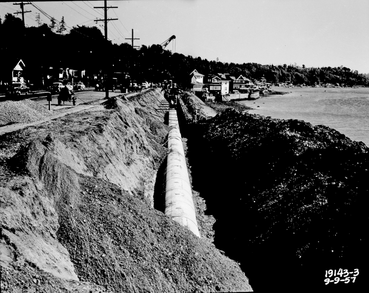
Emma Schmitz Overlook is located at 4503 Beach Drive SW, south of Alki Point in Seattle. The site includes a seawall built around 1927 that has deteriorated over time. Currently coastal storms and erosion threaten public infrastructure located in and around the seawall, including a 54-inch King County sewer main, a major public arterial, city park property and other underground utilities. The recommended plan includes construction of a soldier pile seawall parallel to the shoreline throughout the study area. The new seawall would be a few feet higher and seaward of the existing seawall. This would provide protection against damages caused by coastal storm events that occur in Puget Sound.
In 1998, the City of Seattle was prompted to take emergency action to stabilize the shoreline to the north of the proposed federal project when storm waves resulted in the failure of a similar section of existing seawall and subsequent erosion of shoreline protection that threatened utilities, roadways, and public lands. The city completed permanent emergency repairs on this adjacent site, which is not included in the scope of the proposed Federal project.
The recommended plan was chosen because it has the least environmental impacts, cost the least cost and meets all project purposes. Coordination with resource agencies and federal tribes is ongoing and preliminary indications expect a concurrence with the project.
The implementation cost of the recommended plan is estimated to be $2.29 million and will be cost-shared 65 percent federal ($1,488,000) and 35 percent non-federal ($801,000). The non-federal sponsor, Seattle Parks and Recreation, is responsible for all lands, easements, right-of-ways, relocations, and/or disposal areas which are controlled by the sponsor. Economic analysis suggests the project could prevent millions of dollars of physical and non-physical damages, resulting in a favorable benefit-cost ratio.
Submit comments to this office, Attn: Environmental and Cultural Resources Branch, no later than December 31, 2014 to ensure consideration. In addition to sending comments via mail, comments may be e-mailed to Melissa.L.Leslie@usace.army.mil. The Notice of Availability and Draft DPR/EA can be found at the following website: http://www.nws.usace.army.mil/Missions/Environmental/EnvironmentalDocuments/2014EnvironmentalDocuments.aspx. Requests for additional information should be directed to Ms. Melissa Leslie at 206-764-6587, or the above e-mail address.
###Tanya M. King
Public Affairs Specialist
U.S. Army Corps of Engineers, Seattle District
206-764-6958 (office)
206-422-2679 (cell)
206-764-3769 (fax)
http://www.nws.usace.army.mil
I would like to think that this project could grease the skids of King County in favor of Beach Drive residents considering to raise their own seawalls from events caused by global warming.
 Emma Schmitz Park seawall circa 1968. Photo credit to City of Seattle archives
Scupper, reporting for Beach Drive Blog


Recent Comments